June 19 Hike description
Here's a graphic picture of the elevation

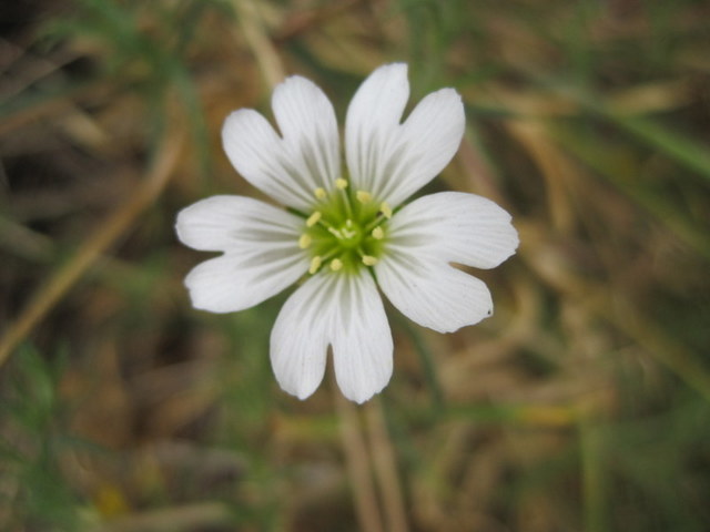
Here are some of the great pics our party took!
Some great views!
.jpg)
.jpg)

And some interesting sights on the hike!


Our plan worked really well! The two groups met up as expected (no coffee and bannock, of course). Overall, this was one of the best hikes we've done - certainly the best exercise!
Directions
This time we'll have two parties. One party will be dropped off at the bottom of the direct route (see exploratory hike description below). The other party will continue to the parking spot we used last time - see picture and directions below.The two parties will proceed to the summit by the direct route and the easy route respectively - meet up and return to the cars by the easy route. The direct route will take about 90 mins and the easy route about 50 mins, so the easy route walkers will have plenty of time to get a fire started to cook bannock and make coffee!! (Just joking, of course).

Below are description from our previous two expeditions. They were both great hikes...


This time we'll have two parties. One party will be dropped off at the bottom of the direct route (see exploratory hike description below). The other party will continue to the parking spot we used last time - see picture and directions below.The two parties will proceed to the summit by the direct route and the easy route respectively - meet up and return to the cars by the easy route. The direct route will take about 90 mins and the easy route about 50 mins, so the easy route walkers will have plenty of time to get a fire started to cook bannock and make coffee!! (Just joking, of course).
Directions
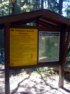
Car poolers will meet at the centre at 9:15, and should be at the park entrance on Finlayson Arm Road at 9:35 for those joining us there for the easy route. The direct ascent party will have been dropped off en route to the car park. Here is the car park (.7k from the Gowlland Tod Park)

Below are description from our previous two expeditions. They were both great hikes...

.. and we found out something about young Rod Finlayson. He died in the same year (1892) that my grandfather was born - so not quite contemporaneous, but he may have been a contemporary to one of my contemporaries, depending on when he passed away. Just - checked his Wikipedia entry and we miss this by about 9 months. Rod died in January 1892, but my granddad wasn't born until September.

Oh - well. This hike was a good cardio workout,, and it's quite satisfying to climb Mount Finlayson.
We'll hike to the Mt Finlayson summit - the easy way - and return by the same trail. Should take 45 to 50 mins each way. There is some elevation change on this route, but it's much more gentle than the direct route to the summit.
Google Map
Description of our exploratory hike on September 3, 2011
Chris and I tried the direct ascent - this blog had great pictures and description of the ascent which is just about 1.5 k but took us an hour and a half just to get to the summit. It was a fantastic hike but might be a bit challenging for the Tuesday Ad Hoc Hikers!
We took some pictures as well. The view was pretty good.


Here's the survey marker!


We took the trail through towards Gowlland Tod, which was a much easier descent than trying to go straight back down the trail. After about 2 to 3 k this took us out to Finlayson Arm Road and this marked park entrance.


It was then 3.1 k back down Finlayson Arm Road to the car park next to the information notice, where we had left our vehicle. The summit is about 1200ft (420 m) but this longer hike down was more gentle on our knees.
So the direct route to the summit was about 1.5 k and took 1.5 hours. The summit back to the car took about 1.5 hours as well. I'm suggesting we park here on October 4, 2011 ( on Finlayson Arm Road) and
walk to the summit and back on the relatively gentle trail. Takes about 50 minutes each way.
No comments:
Post a Comment