Sunday, May 20, 2012

June 12, 2012 Skirt Mountain Viewpoints

We followed the track below but didn't do the furthest viewpoint this time. This hike is really good for cardio exercise and has some really interesting viewpoints.


Not to mention the exotic fox-glove grove!


I said not to mention that!

Directions
Carpoolers should leave the centre at 9:15, and those meeting at the trailhead should be at the car park at the north end of Brock Avenue at 9:30.

Here's the Google map with directions to the trail head.


View Larger Map

Here's the Google map of the hike track.


View Skirt Mt Via Unfinished Road in a larger map


This is a really interesting hike with some of the best and most interesting viewpoints around.  There are some short cardio sections getting up to the viewpoints, and the associated descents are just as steep on the way down as they were on the way up.  However, the views are worth the effort.

Here are Dwayne's pictures of the recon we did on Saturday, May 19, 2012.


Here's the MotionX track of the hike.


Name:Skirt Mountain Viewpoints
Date:May 19, 2012 9:56 am
Map:
(valid until Nov 16, 2012)
View on Map
Distance:8.29 kilometers
Elapsed Time:2:06:44
Avg Speed:3.9 km/h
Max Speed:20.4 km/h
Avg Pace:15' 17" per km
Min Altitude:68 m
Max Altitude:313 m
Start Time:2012-05-19T16:56:35Z
Start Location:
Latitude:48.455494º N
Longitude:123.510825º W
End Location:
Latitude:48.455268º N
Longitude:123.511208º W

Monday, May 14, 2012

Christmas Hill and Swan Lake Loop, September 17, 2013

Track for September 13, 2013

View Christmas Hill and Swan Lake - September 17, 2013 in a larger map

Slideshow


September 17, 2013
Name:Swan Lake and Christmas Hill
Date:2013-09-17 9:30 am
Map:
(valid until Mar 16, 2014)
View on Map
Distance:5.86 kilometers
Elapsed Time:1:55:05
Avg Speed:3.1 km/h
Max Speed:34.4 km/h
Avg Pace:19' 38" per km
Min Altitude:0 m
Max Altitude:115 m
Start Time:2013-09-17T16:30:32Z
Start Location:
Latitude:48º 27' 57" N
Longitude:123º 22' 27" W
End Location:
Latitude:48º 27' 57" N
Longitude:123º 22' 27" W


INSTRUCTIONS
Car poolers meet at the Senior's Centre at 9:15. The drive to the Swan Lake parking lot is about 16 minutes, so anyone wanting to meet at the parking lot should be there by 9:35.
First we will take the trail up to Christmas Hill and do the loop around the top to enjoy the views of Victoria and Saanich. Then we will trek back to Swan Lake and do the lake loop clockwise, crossing the bridge, ending up at the Nature House and parking lot. There is an uphill climb to the top of Christmas Hill, but the loop around Swan lake is almost level. Christmas Hill will take about 1:00 and the lake loop will take about 0:45, for a total of about 1:45 to 2:00. The stone steps on Christmas Hill and the bridge across Swan Lake can be expected to be slippery when wet.  
How to get there:
Getting back on to McKenzie westbound when returning:

A few of us did this walk on March 12, 2012.  Here is the report.

The weather was extremely changeable for the hike today.  It was pouring when we got up and looked at the weather.  Then it turned into a nice sunny morning; then it clouded in as we went on the hike but stayed mainly clear and somewhat sunny.  We went to Christmas hill first, and then took the path the circumambulates the summit.


 There were spring flowers poking through..


and this moss looked a bit like the surface my tongue, although my tongue is much more browny.


It was windy and it did rain just as we got to the summit, but the rain eased off as we continued the hike.


The walk around Swan Lake was excellent, and again the weather cooperated.


We passed a group of hikers just after this point. Just burned them off...

Just as we got home it started to rain very heavily with hail and snow.  Then it eased off.  It's raining again now in the evening....etc.  etc...etc...

This is a great hike.  It's a bit muddy in some spots, but I suppose most places are after the rain we've had over the last few weeks, but the mud was no challenge to our new hiking boots!  We still haven't tried all the different trails around Christmas Hill, especially the Lake View trail.  We'll be trying those some other time.


Name:Track 001
Date:Jan 3, 2012 9:33 am
Map:
(valid until Jul 1, 2012)
View on Map
Distance:5.53 kilometers
Elapsed Time:1:06:55
Avg Speed:5.0 km/h
Max Speed:21.1 km/h
Avg Pace:12' 06" per km
Min Altitude:0 m
Max Altitude:102 m
Start Time:2012-01-03T17:33:30Z
Start Location:
Latitude:48.466009º N
Longitude:123.374080º W
End Location:
Latitude:48.465827º N
Longitude:123.374247º W

MotionX-GPS Commonly Asked Questions
  1. What is MotionX-GPS?
    MotionX-GPS is the essential GPS application for outdoor enthusiasts. It puts an easy-to-use, state-of-the-art handheld GPS on your iPhone.
  2. Can I use MotionX-GPS?
    Sure! MotionX-GPS can be downloaded from the iTunes App Store.
  3. How can I display tracks in Google Earth?
    Follow the directions on the Google Earth web site to download and install the Google Earth program. Save the attached "Track 001.kmz" file to your computer. Launch Google Earth, select File, Open, and open the saved "Track 001.kmz" file.
  4. This email was forwarded to me. Where are the attachments?
    Some e-mail programs do not include the original attachments by default when forwarding an e-mail. In this case, the sender must reattach the original files for them to be included.

Please contact MotionX customer support with any comments or questions.
All the best,
The MotionX Team

Sunday, May 13, 2012

June 5, 2012 North Thetis Lake Loop


North Thetis Lake figure of eight.

Here's our track

Great hike, and we got to talking about happiness being like a butterfly, but it turns out it may be more like a cat.


We saw quite a bit of Marsh Lantern


the crying bridge


and some great flowers


Car poolers should leave the centre at 9:15, and those joining us at the trail head should be there at 9:30. We'll meet at the parking lot on highland road just next to the bridge over Mackenzie Creek shown on street view.


View Larger Map

This is the loop for the recon Dwayne and I did on Saturday, May 12, 2012.  As you can see from the track, we took a wrong turn and ended up bushwhacking through muskeg, salal, and holly.  Dwayne was first to notice the holly as he was wearing hiking shorts.  However, we went back and identified the complete loop which included a glimpse of nudists sunning themselves at Prior Lake. As you can see, on the correct hike, we will go one order of complexity better than a loop; we will be doing the figure of eight! The trail is quite rugged with some cardio sections.  There are some fantastic creekside areas.  If you like shady nooks and babbling brooks, this is for you!

The hike will probably take about two hours and be about 8 k.

Here's Dwayne's track


Park map

Dwayne's pics from the recon


Gently babbling - and that's just the brook


I think this was Prior Lake


Glimpse of naturalists at play! This was Prior Lake.  Fortunately (?) we'd brought powerful binoculars!


My track


Name:Upper Thetis 2
Date:Jun 5, 2012 9:28 am
Map:
(valid until Dec 2, 2012)
View on Map
Distance:7.61 kilometers
Elapsed Time:1:33:05
Avg Speed:4.9 km/h
Max Speed:10.9 km/h
Avg Pace:12' 14" per km
Min Altitude:21 m
Max Altitude:77 m
Start Time:2012-06-05T16:28:41Z
Start Location: 
 Latitude:48.478308º N
 Longitude:123.463967º W
End Location: 
 Latitude:48.478282º N
 Longitude:123.463922º W


Friday, May 11, 2012

May 29, 2012 Hillside to WIllow Beach - the return

This was another great hike.  Here's our track for the loop.


Name:Hillside Willows Loop
Date:May 29, 2012 9:35 am
Map:
(valid until Nov 25, 2012)
View on Map
Distance:11.4 kilometers
Elapsed Time:2:20:21
Avg Speed:4.9 km/h
Max Speed:16.4 km/h
Avg Pace:12' 17" per km
Min Altitude:0 m
Max Altitude:32 m
Start Time:2012-05-29T16:35:15Z
Start Location: 
 Latitude:48.443563º N
 Longitude:123.338090º W
End Location: 
 Latitude:48.444617º N
 Longitude:123.336957º W


We enjoyed the Thursday Ramblers Hillside to Willow Beach walk so much that we are doing it again  on May 29. This time we'll be doing a loop, and returning to our starting point. After all, that's the nature of loops. It will be a great 10k or so with a lunch break and possibly even a coffee break as well.

Directions
Meet at Hillside Mall by Thrifty's, near fence at 9.35. Car poolers should leave JDF 9.15. Bring snack/lunch to eat at Willow Beach.


View Larger Map


Here's the track for the one-way from Hillside Mall to WIllow Beach.

Name:Hillside to Willow Beach
Date:May 10, 2012 9:36 am
Map:
(valid until Nov 7, 2012)
View on Map
Distance:5.49 kilometers
Elapsed Time:1:10:49
Avg Speed:4.7 km/h
Max Speed:21.7 km/h
Avg Pace:12' 54" per km
Min Altitude:0 m
Max Altitude:24 m
Start Time:2012-05-10T16:36:52Z
Start Location:
Latitude:48.444704º N
Longitude:123.338250º W
End Location:
Latitude:48.435604º N
Longitude:123.302234º W

Wednesday, May 2, 2012

Tuesday, June 19, 2012 Mount Finlayson both ways


June 19 Hike description


Here's a graphic picture of the elevation

Here are some of the great pics our party took!

Some great views!


And some interesting sights on the hike!


Our plan worked really well!  The two groups met up as expected (no coffee and bannock, of course). Overall, this was one of the best hikes we've done - certainly the best exercise!
Directions
This time we'll have two parties.  One party will be dropped off at the bottom of the direct route (see exploratory hike description below).  The other party will continue to the parking spot we used last time - see picture and directions below.The two parties will proceed to the summit by the direct route and the easy route respectively - meet up and return to the cars by the easy route. The direct route will take about 90 mins and the easy route about 50 mins, so the easy route walkers will have plenty of time to get a fire started to cook bannock and make coffee!! (Just joking, of course).


Directions
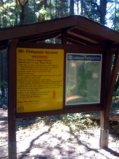
Car poolers will meet at the centre at 9:15, and should be at the park entrance on Finlayson Arm Road at 9:35 for those joining us there for the easy route. The direct ascent party will have been dropped off en route to the car park.  Here is the car park (.7k from the Gowlland Tod Park)


Below are description from our previous two expeditions.  They were both great hikes...


.. and we found out something about young Rod Finlayson. He died in the same year (1892) that my grandfather was born - so not quite contemporaneous, but he may have been a contemporary to one of my contemporaries, depending on when he passed away. Just - checked his Wikipedia entry and we miss this by about 9 months. Rod died in January 1892, but my granddad wasn't born until September.


Oh - well.  This hike was a good cardio workout,, and it's quite satisfying to climb Mount Finlayson.

We'll hike to the Mt Finlayson summit - the easy way - and return by the same trail. Should take 45 to 50 mins each way. There is some elevation change on this route, but it's much more gentle than the direct route to the summit.

Google Map


Description of our exploratory hike on September 3, 2011
Chris and I tried the direct ascent - this blog had great pictures and description of the ascent which is just about 1.5 k but took us an hour and a half just to get to the summit.  It was a fantastic hike but might be a bit challenging for the Tuesday Ad Hoc Hikers!

We took some pictures as well. The view was pretty good.


Here's the survey marker!


We took  the trail through towards Gowlland Tod, which was a much easier descent than trying to go straight back down the trail.  After about 2 to 3 k this took us out to Finlayson Arm Road and this marked park entrance.


It was then 3.1 k back down Finlayson Arm Road to the car park next to the information notice, where we had left our vehicle. The summit is about 1200ft (420 m) but this longer hike down was more gentle on our knees.

So the direct route to the summit was about 1.5 k and took 1.5 hours.  The summit back to the car took about 1.5 hours as well.  I'm suggesting we park here on October 4, 2011 ( on Finlayson Arm Road) and


walk to the summit and back on the relatively gentle trail.  Takes about 50 minutes each way.