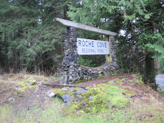
We'll meet at last week's stop - the parking lot at 5410 Rocky Point Road. It's about 10 K to the next stop - the intersection of Sooke Road and the Goose. We will board the vehicle left there for the return trip to the Rocky Point Road lot.
We should be able to park Kathy's van here (around 5512 Sooke Road) near the Shell station and mail boxes on the right. This view is looking back along Sooke Road.
View Larger Map
Description from the official guide
From the parking lot off Rocky Point Road, the Goose heads straight into
Matheson Lake and Roche Cove regional parks. The Goose changes
character again. From the pastoral setting of Metchosin, the trail crosses
into semi-wilderness. The trail surface is still hard packed and comfortable of course, but the scenery gets wilder and greener. Pockets of Western Red Cedar, low lying skunk
cabbage swamp, glimpses of Matheson Lake and Roche Cove, and
creeks emerging from fern forests reward the traveller.
Heading west past Roche Cove, the trail crosses Gillespie Road (use
extreme caution: a blind curve in the road) and skirts Sooke Basin, clinging to the coves and headlands along the north shore to the small peninsula of Milnes Landing.
Savour this section of the Goose. There are few multi-use trails along the west coast that offer cycling this close to the Pacific Ocean. The trail dips steeply down into Veitch Creek
near Hutchison Cove. Most cyclists hustle quickly over the bridge and climb up the other side. But they miss one of the gems of the Goose. Stop on the side of the bridge and
enjoy the spectacular view of Veitch Creek as it flows over exposed bedrock and out into the basin. Sooke River Valley Near Coopers Cove (3 km west of Roche Cove) the Goose heads north across Sooke Road (use extreme caution on this busy highway!) and
visits the neighbourhood of Ayum Creek before heading north into the
Sooke River Valley.
Dwayne's Track and pictures January 28, 2013
View Galloping Goose 4 Rocky Pt Rd to Sooke Rd Jan 28, 2013 in a larger map
Lots of water and lush vegetation, with all the rain.
Matheson Lake.
Three otters frolicking - only two came close enough to have their photos taken
Steep cliffs - sounds like an invitation to go and look
Remnants of old railway ties.
Sooke Basin.
Did anyone see the Spitfire near 36 km?
Eye test.
Ex Canadian Forces minesweeper.
Below -Telegraph pole from the old days
Sooke Rd and the end of GG4.


No comments:
Post a Comment