Monday, October 10, 2011

October 9, 2012 Royal Roads escorted hike


Hike Directions
Patti Walsh -  Manager, Recreation Centre, whom we met on our last visit to RRU will meet us at 9:30 at the Rec Centre to take us on a conducted hike of some of the trails.  We can park in the Rec Centre car park and Patti will give us free parking passes.

Here's someone's description of Charlie's Trail.

Again, we will be meeting at the RRU Rec Centre at 9:30.

Photographed at RRU.


Dwayne's Track and Pics for October 9, 2012 Hike

Here's the track we took - 7.2 k - another great hike. Thanks again, Patti!


Report for October 25, 2011 Royal Roads escorted hike

The largest (and best looking) group we've had so far on these hikes met up with Patti at 9:30 as planned.  We headed off down Charlie's Trail and did see an owl like the one at the very end of this entry (someone else's photo). The photo from my iPhone wasn't quite as good (by a very long way), but is evidence that we saw the owl.


We also noted the fallen tree that had formed a bridge over the creek.


Next we headed over to the cheese house (purpose not yet identified but probably not a euphemism).  Experts at the university are investigating, and we may be able to get more information in the future.


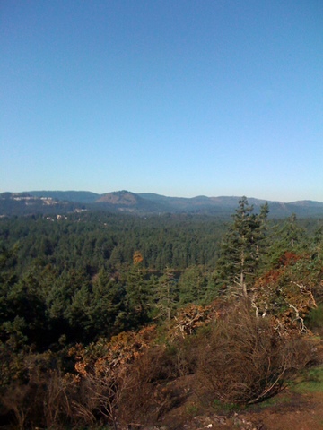
We went from there to the most superb viewpoint over the lagoon.


Worth two shots!

After enjoying the view we explored the edge of the RRU grounds that lead to the lagoon and Fort Rod Hill.  On the way, we stopped off to view the foundations and part of the patio of the Dunsmuir daughter's house.  Patti had unearthed some old pictures of the house from around the 1920s, and it was interesting to compare the photos with what was left on the ground.  Hopefully we'll be learning more about this aspect in the future as more information is pieced together.


Next we went past the new building and onto part of the 5K trail to see a special place that isn't on any of the maps. On the way, we said "Hi" to one of Patti's three favourite trees in the grounds.


It's hard to capture the immense size and presence of this giant, but it would probably have taken all twelve of us together to give it a encircling hug.


This special place may have been sacred to Natives and may have been especially important to Aboriginal women.

Patti has been part of setting up an investigation into the history of the site with the university's Aboriginal liaison.  We may be able to learn more about this later.

Also, it's possible that Patti may be able to arrange a tour with the RRU arboreal specialists (the tree guys - although there may only be one of them on our visit (thanks to Benny Hill for this attempted witticism)).

We had a fabulous 8K ramble today with some excellent information and company from Patti.  I'm sure we'll be planning to visit again next year to check out the rest of the trails and perhaps have a visit with the tree or history experts from RRU as well as with Patti.

Patti gave us copies of a new trail map, part of an upcoming hiking book. Thanks again for an excellent hike!!



Tuesday, October 4, 2011

June 4, 2013 Gowlland Tod Caleb Pike - Holmes Peak/Roundtree Loop (or Jocelyn Peak)


Hike directions

Car poolers will leave the centre at 9:15 and will be arriving at the Caleb Pike Access to Gowlland Tod Provincial Park at around 9:35.


Google map


View Larger Map

Trail Map

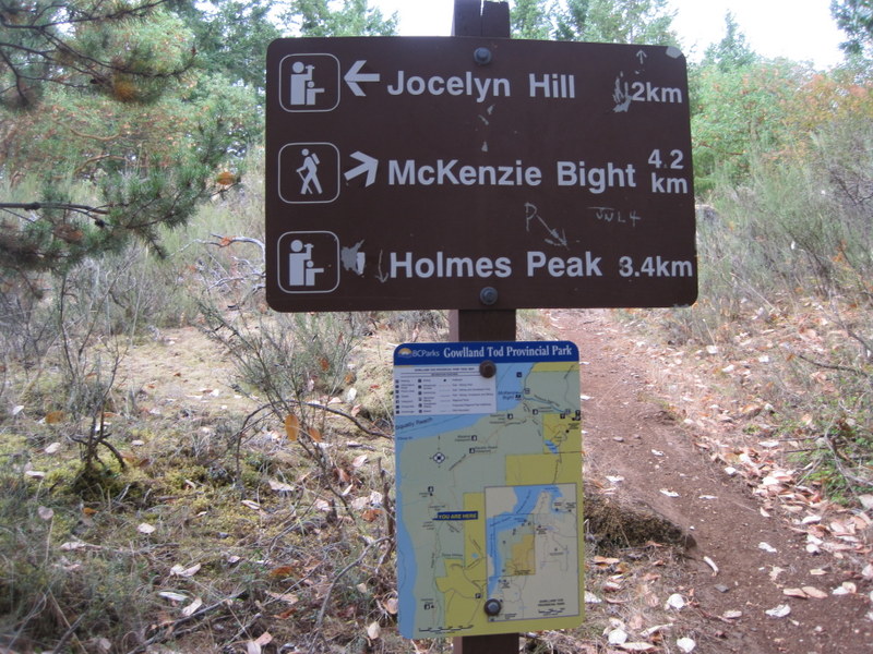
From the Caleb Pike Access car park we will take the trail to Holmes Peak (about 1K). After enjoying the view at Holmes Peak, we will continue for about 200m and make a right onto the Holmes Peak Bypass trail and make our way back to the car park and intersection with the multi-use Roundtree Loop (about 1K). We will then do the loop clockwise (right fork) taking in the two view points; we will be hitting the Misery Bay Viewpoint second as a possible lunch stop. The Roundtree Loop is about 2k, so the hike should be about 4.5K overall.

This time we might decide to go on to Jocelyn Hill rather than do the Roundtree Loop. In this case, the hike would be about 8K.

We could check out the Caleb Pike Heritage Park after our hike.

Hike description and pics August 28, 2012

View Gowlland Tod Caleb Pike August 28, 2012 in a larger map


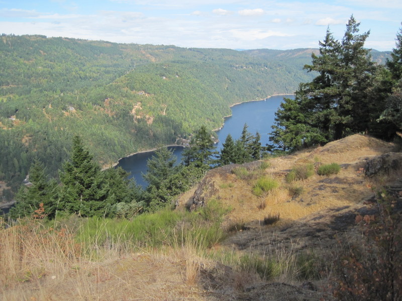
We decided to continue past Holmes Peak heading towards the Jocelyn Hill viewpoint.  We turned round short of Jocelyn Hill, but were rewarded by excellent viewpoints en route.


Hike description November 1, 2011

A great hike this morning.  OK we started out five minutes late and lost the other car in our convoy before even leaving the centre car park but we all met up at the Caleb Pike car park.  We "decided" to take the Roundtree Loop first which was good because we got to see all the viewpoints.  The views were spectacular.


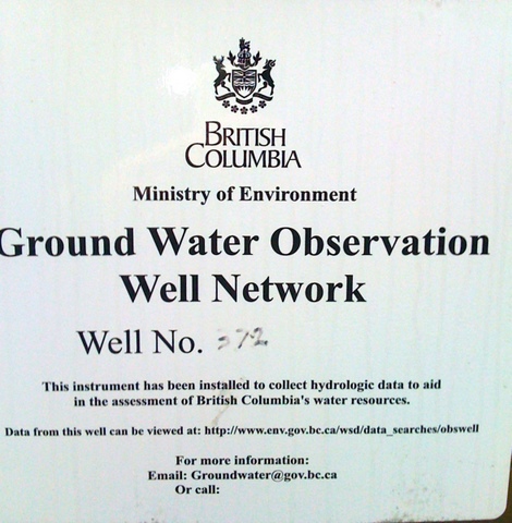
After completing the Rondtree Loop, we called in to see Well 372 of the Ground Water Observation Well Network. Check out the site listed on the well.


These asre the current data from our favourite well. It looks as if the ground water level is around 60 m below the surface at that point.  Previous data suggest that the level increases in winter (dah!) and then falls off again in summer!


Holmes peak was a great hike and leads to another excellent view. On the way there we saw this interesting looking fungus.


The hike is good for cardio exercise but isn't too strenuous. There are great views and a few places to stop for a breather during the hike. Another time we might take the Roundtree and carry on to Mount Finlayson and back via the other leg of the loop, or do a one- way from Caleb Pike car park to the Ross-Durrance Road car park taking in the Jocelyn Hill viewpoint.


Sunday, October 2, 2011

Thetis Lake via Connector Trail - October 22, 2013


Directions

We will leave the centre at 9:15 and will arrive at Avery Court at around 9:30.  We will use the connector trail to get to the Thetis Lake car park (1.3 k each way) to complete the feature hike (short version - about 1 hour) and return via the connector trail.

Track


View Thetis Lake From Phelps Avenue - October 22, 2013 in a larger map


Viewranger map

Slideshow


Photos


Details

Name:Thetis lake connector
Date:Aug 21, 2012 9:28 am
Map:
(valid until Feb 17, 2013)
View on Map
Distance:7.15 kilometers
Elapsed Time:1:39:29
Avg Speed:4.3 km/h
Max Speed:12.0 km/h
Avg Pace:13' 55" per km
Min Altitude:43 m
Max Altitude:133 m
Start Time:2012-08-21T16:28:22Z
Start Location:
Latitude:48º 27' 49" N
Longitude:123º 29' 08" W
End Location:
Latitude:48º 27' 49" N
Longitude:123º 29' 08" W


Feature Hike


Feature Hike

Thetis Lake Regional Park

Lewis Clark Trail to Seymour Hill

Trail Rating: Moderate
Approximate Hiking Time: 1 to 1.5 hours

Highlights

This hike gives you a nice taste of the variety this park has to offer. You'll get some good exercise, fabulous views at the top and a sampling of the lakeshore trail on the way back.

The Hike

Begin your hike at the map kiosk at the end of the parking lot. From here, take the right hand trail. It's a gradual climb through Douglas-fir forest into Garry oak/arbutus/Douglas-fir woodland. Once up there, the trail winds up and down, with great hilltop views and dappled woodland trails.
Where the trail meets up with the Seymour Hill Trail, take a right up the hill. A directional cairn near the 131-metre summit, built in 1968 by the Thetis Lake Nature Sanctuary Association, provides sight lines of local mountains, including Mount Finlayson and Mount Work. The nearby view looking down on the lakes is magnificent, making this a "lunch-worthy" spot.
To find the trail down the other side, make a left from the cairn (when your back is to the lakes). The first portion of this trail is steep, so tread with care. Keep to your left along this trail and it will take you back to the trail that skirts Lower Thetis Lake. A left turn along this trail will take you along the lake back to the parking lot.

Option

If you want to extend your hike, turn to the right and you have the option of taking the trail around one or both lakes. Total hiking time including an extended trek around both lakes is 2.5 to 3 hours.


Google Map


View Larger Map

Trail map

Connector Trail Map


Description of Tuesday, October 18, 2011 hike
Welcome to Carol who joined the group this morning.  We had an excellent hike thanks partly to Dwayne for having checked out the trail yesterday, and partly to the weather for being so pleasant.  The connector trail is an excellent way to get to Thetis Lake Park from Langford on foot.  From the main car park at Thetis, the Seymour Hill Trail was excellent and as described in the feature hike below.  The water was like a sheet of glass this morning.


We did stop a couple of times to admire the view, and we deviated from the feature hike by turning right to complete a loop of Lower Thetis Lake on the way back to the connector trail. Overall it was about 8K and an excellent hike to add to our growing collection.


This plaque is dedicated to Dr. Lewis J Clark the conservationist.  Not to be confused with Lewis and Clark, who were in fact two different people completely. Notice the stone crop!


As I said, the views were extra especially spectacular and were particularly good this morning.


This hike is a keeper - the connector trail followed by a loop of Lower Thetis with an associated loop of Seymour Hill Trail.  As Kathy said - a loop de loop!

Thanks to Dwayne for these pics from his recon yesterday!


Great pics.


Francis King Park - Centennial and High Ridge Trails - October 15, 2013


Directions 

Car poolers will leave the centre at 9:15 and will be at the car park around 9:25.

We will follow the Centennial Trail to the NE and follow it around a half circle to cross Munn Road after about 1.35 k.  We will have gone by the Shooting Star Trail on the left and the Grand Fir trail, which crosses the Centennial Trail before hitting Munn Road.  Crossing Munn Road, the Centennial Trail jogs first right and then first left and then left at the trail, to head W on Centennial Trail. About 1.1 K after Minn Road, we should join High Ridge Trail.  We pass one trail on the left after about 400 M, and after about 400 M we turn right to stay on the Centennial but bear left at the next intersection immediately after. We turn right on High Ridge Trail, stay on the trail (straight on) at the first intersection and bear left at the next intersection to complete the loop back to High Ridge. We turn right back on High Ridge and carry on to rejoin Centennial Trail. We go straight on (bear right) to follow Centennial back across Munn Road heading  NE to get back to the car park. We will have crossed two trails bearing right at the first and left at the second. Total for this complete route is about 4.6.  We should have time to browse the information centre (if open) and stroll the Elsie King Trail if we want.

Track

View Francis King Park - October 15, 2013 in a larger map

Slideshow


Pictures


Park info

Francis King regional Park

Trail map

Location map

Google map


View Larger Map


Description of October 11, 2011 hike

Our plan was simple - follow the Centennial Trail counter-clockwise from the nature centre to the High Ridge Trail, follow the High Ridge trail loop back to the Centennial and then back to the nature centre. Despite our best efforts, we ended up off the Centennial Trail somewhere after crossing Munn Road. It was an interesting diversion with us clambering across and under fallen trees and across the dry creek, and we ended up back on the Centennial trail having had a close and interesting view of the golf course and park boundary. After our diversion, we followed the planned route.


It was a cloudy morning, but we were not too affected by rain.  Pedometers indicated that we did between 6.5 and 8 K compared to the 4.6K taken from the map. Overall this was a really nice hike with some elevation change.  It would couple well with a lunch break back at the nature centre and exploration of the wheelchair accessible Elise King Trail.

Francis/King Regional Park is named after Thomas Samuel Francis and Freeman King. In 1960, Thomas Francis donated the bulk of the land that comprises the park and in 1967, a section on the west side of Munn Road was added and named in honour of Freeman King (Liz Crocker, 1999)

Liz Crocker's report has some history of Three Regional Parks and is quite interesting.

Next time we do this hike it will be in the reverse direction!


Saturday, September 3, 2011

Finlayson Summit the easy way - October 8, 2013


View Mt Finlayson - March 19, 2013 in a larger map


Hike instructions

Car poolers will meet at the centre at 9:15, and should be at the park entrance on Finlayson Arm Road at 9:35 for those joining us there. Here is where we can park (.7k from the Gowlland Tod Park)


We'll hike to the Mt Finlayson summit - the easy way - and return by the same trail. Should take 45 to 50 mins each way. There is some elevation change on this route, but it's much more gentle than the direct route to the summit.

Google Map


View Larger Map


Click here for park map.


Description of October 4, 2011 hike

A great hike; good weather for the climb and descent - cool but no rain. The view from the summit was inspiring and atmospheric..


.. and we found out something about young Rod Finlayson. He died in the same year (1892) that my grandfather was born - so not quite contemporaneous, but he may have been a contemporary to one of my contemporaries, depending on when he passed away. Just - checked his Wikipedia entry and we miss this by about 9 months. Rod died in January 1892, but my granddad wasn't born until September.


Oh - well.  This hike was a good cardio workout,, and it's quite satisfying to climb Mount Finlayson.


Description of our exploratory hike on September 3, 2011
Chris and I tried the direct ascent - this blog had great pictures and description of the ascent which is just about 1.5 k but took us an hour and a half just to get to the summit.  It was a fantastic hike but might be a bit challenging for the Tuesday Ad Hoc Hikers!

We took some pictures as well. The view was pretty good.


Here's the survey marker!


We took  the trail through towards Gowlland Tod, which was a much easier descent than trying to go straight back down the trail.  After about 2 to 3 k this took us out to Finlayson Arm Road and this marked park entrance.


It was then 3.1 k back down Finlayson Arm Road to the car park next to the information notice, where we had left our vehicle. The summit is about 1200ft (420 m) but this longer hike down was more gentle on our knees.

So the direct route to the summit was about 1.5 k and took 1.5 hours.  The summit back to the car took about 1.5 hours as well.