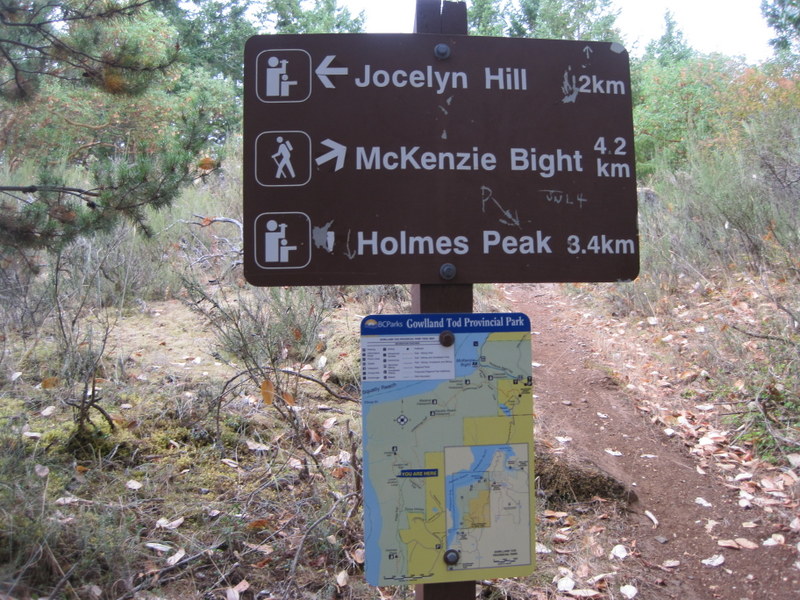
Sunday, October 23, 2011

Handy hike sheet

Print and cut out for your wallet/purse


Oct 25 RRU hike
Nov 1 Caleb Pike Holmes Peak
Nov 8 Horth Hill
Nov 15 Witty's Lagoon to Tower Point
Nov 22 John Dean Park
Nov 29 Christmas Hill and Swan Lake Loop
Dec 6 Thetis Lake
Dec 13 Sidney waterfront/ lunch
XMAS BREAK
Jan 17 Elk/Beaver Lake

January 17, 2012 Elk/Beaver Lake - snow

January 17, 2012 Elk/Beaver Lake

The snow seemed against us, but four  intrepid Ad Hoc Hikers did the 10K round Elk Beaver Lake as planned.

It was decidedly snowy at the start....


 ...but we were treated to some excellent views on the way round.


We saw a number of cormorants - like this one...


...and there were quite a few other hearty souls on the walk - in fact they were all more hearty than usual - no doubt proud to be out walking on a snow day!  Next time we do this hike it will be counter-clockwise to ensure we unwind properly!

DIRECTIONS
Welcome to the Tuesday Ad Hoc Hikers' inaugural hike for 2012.  Be there or be cuboid in general structure!  (or take a break until the weather improves!)

This hike might seem similar to one that we took in 2011, but this time we're doing it clockwise!!


MotionX Track
Name:Elk/Beaver lake 10K
Date:Jan 17, 2012 9:51 am
Map:
(valid until Jul 15, 2012)
View on Map
Distance:10.2 kilometers
Elapsed Time:1:59:24
Avg Speed:5.1 km/h
Max Speed:29.6 km/h
Avg Pace:11' 42" per km
Min Altitude:47 m
Max Altitude:77 m
Start Time:2012-01-17T17:51:03Z
Start Location:
Latitude:48.524418º N
Longitude:123.389018º W
End Location:
Latitude:48.528084º N
Longitude:123.387052º W


Elk/Beaver Lake

Click for Park brochure
Outdoor opportunities for everyone

10k hike clockwise from Beaver Beach Car Park (with washrooms, shelters, playground etc.). We will park adjacent to the playground equipment shown in this picture and start the hike from the tree shown in the picture.We'll stop for breaks on the way round the trail.

Directions from Victoria and map


BEAVER LAKE ENTRANCE
Follow the Pat Bay Highway from Victoria, and take the Royal Oak
Drive exit.Turn left on Royal Oak Drive to cross over the
highway, then right on Elk Lake Drive to reach the park entrance.
Allow approximately 20 minutes driving time from Victoria.

Google map from the centre


View Larger Map

Driving time is approximately 25 mins.  Car poolers will be leaving the centre at 9:15.  If meeting at the park, please be there at 9:40.

December 13, 2011 Sidney Waterfront and Christmassy lunch

December 13, 2011 Sidney Waterfront and Christmassy lunch

A dozen of us met up for a great Christmas lunch celebration with a heart smart walk thrown in.


This is where we met up.  Also, our convoying skills seem to have improved!!


The walk is really scenic!!


We decided to check into more ferry based trips.  Sidney Spit is one obvious possibility..


... as is Portland Island.  Lunch at the Rumrunner was great!!  Merry Christmas and a Happy New Year to everybody!!


Sidney Waterfront walk

Hike Directions


Car poolers will be leaving the centre at 9:15 and arriving at around 9:50 at roadside free parking on the seafront on Lochside Drive south of and in view of the ferry terminal.  We'll take the waterside walk described below until it peters out at the marina and walk to a Sidney restaurant (suggestions please) for Christmassy lunch and our wind up for the year.  Our next planned hike is Jan 17, 2011. We'll have to collect names to get numbers for a booking at the restaurant, so stand by for an email requesting this.


Sidney Waterfront promenade


Sidney's 2km/1.24mi waterfront promenade may not tax too much, but is, without question, the loveliest hike in town. The passing panorama includes Sidney's band shell, which may be in the midst of a summer concert; snow-capped Mount Baker across the Salish Sea; that bronze chappie on the park bench; and the Port Sidney Marina. 


Google Map


View Larger Map

Thetis Lake - September 24, 2013


Hike Directions

Car poolers will leave the centre at 9:15 and should be starting the hike the Thetis Lake main car park at 9:25.

Google Map


View Larger Map

Basic loop

September 24, 2013

View Thetis Lake clockwise - September 24, 2013 in a larger map

Slideshow


Pictures


Extended hike

We take the Thetis Lake Trail counter-clockwise around Lower Thetis Lake until we meet Trillium Trail at the junction of the two lakes.  We then head south on Trillium until we hit Upper Thetis Lake Trail at the southernmost end of the lakes.  We turn right here and continue our circumambulation of the two lakes but in the clockwise direction.   We follow the two trail loop (retracing the first part of the walk)  back to the cars. Two Lake Loop is 4.5K moderate and Trillium is 2K easy - so about 6.5K


Park Map


Longer version
Name:Track 001
Date:Dec 6, 2011 9:21 am
Map:
(valid until Jun 3, 2012)
View on Map
Distance:6.94 kilometers
Elapsed Time:1:17:34
Avg Speed:5.4 km/h
Max Speed:11.0 km/h
Avg Pace:11' 11" per km
Min Altitude:37 m
Max Altitude:69 m
Start Time:2011-12-06T17:21:18Z
Start Location:
Latitude:48.462834º N
Longitude:123.467167º W
End Location:
Latitude:48.462844º N
Longitude:123.466969º W

Basic Loop
Name:Thetis Lake - Clockwise
Date:Sep 24, 2013 9:25 am
Map:
(valid until Mar 26, 2014)
View on Map
Distance:5.39 kilometers
Elapsed Time:1:49:18
Avg Speed:3.0 km/h
Max Speed:14.5 km/h
Avg Pace:20' 17" per km
Min Altitude:38 m
Max Altitude:79 m
Start Time:2013-09-24T16:25:11Z
Start Location:
Latitude:48º 27' 47" N
Longitude:123º 28' 03" W
End Location:
Latitude:48º 27' 47" N
Longitude:123º 28' 02" W

November 6, 2012 Horth Hill

November 6, 2012: Horth Hill

CRD brochure

Horth Hill description and map

Location Map

Hike Directions

Car poolers will be leaving the centre at 9:15 and should be starting the hike from the Horth Hill parking lot at 10:00.

We will fork right just after leaving the car park and follow the Ridge Trail to the view point.  We will circle the view point ending up on the Sunset BridleTrail that will take us on a wide loop back to the cars. Overall this is around 2.5 K with a max elevation of 136 m.  If time permits we can explore the hiking trail leading SW from the car park and return on a loop via the bridle trail (about 1K).


Google Map


View Larger Map


Hike report from November 6, 2012 (Thanks, Dwayne)


For some reason I keep getting turned around in Horth Hill Park. There are way more trails than shown on any map, and most signs point to either the viewpoint or the parking lot. Hmm.

Tuesday November 6, 2012:
https://maps.google.ca/maps/ms?msid=209938729472309822028.0004cddc5bb2b1b3f7f29&msa=0

All trails trails hiked so far:
https://maps.google.ca/maps/ms?msid=209938729472309822028.0004cdebb2b317da68523&msa=0


Monday, October 10, 2011

October 9, 2012 Royal Roads escorted hike


Hike Directions
Patti Walsh -  Manager, Recreation Centre, whom we met on our last visit to RRU will meet us at 9:30 at the Rec Centre to take us on a conducted hike of some of the trails.  We can park in the Rec Centre car park and Patti will give us free parking passes.

Here's someone's description of Charlie's Trail.

Again, we will be meeting at the RRU Rec Centre at 9:30.

Photographed at RRU.


Dwayne's Track and Pics for October 9, 2012 Hike

Here's the track we took - 7.2 k - another great hike. Thanks again, Patti!


Report for October 25, 2011 Royal Roads escorted hike

The largest (and best looking) group we've had so far on these hikes met up with Patti at 9:30 as planned.  We headed off down Charlie's Trail and did see an owl like the one at the very end of this entry (someone else's photo). The photo from my iPhone wasn't quite as good (by a very long way), but is evidence that we saw the owl.


We also noted the fallen tree that had formed a bridge over the creek.


Next we headed over to the cheese house (purpose not yet identified but probably not a euphemism).  Experts at the university are investigating, and we may be able to get more information in the future.


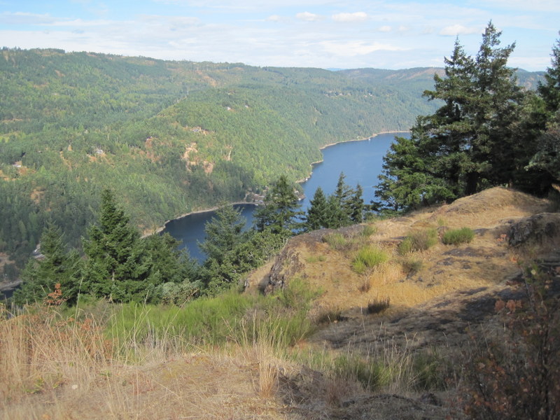
We went from there to the most superb viewpoint over the lagoon.


Worth two shots!

After enjoying the view we explored the edge of the RRU grounds that lead to the lagoon and Fort Rod Hill.  On the way, we stopped off to view the foundations and part of the patio of the Dunsmuir daughter's house.  Patti had unearthed some old pictures of the house from around the 1920s, and it was interesting to compare the photos with what was left on the ground.  Hopefully we'll be learning more about this aspect in the future as more information is pieced together.


Next we went past the new building and onto part of the 5K trail to see a special place that isn't on any of the maps. On the way, we said "Hi" to one of Patti's three favourite trees in the grounds.


It's hard to capture the immense size and presence of this giant, but it would probably have taken all twelve of us together to give it a encircling hug.


This special place may have been sacred to Natives and may have been especially important to Aboriginal women.

Patti has been part of setting up an investigation into the history of the site with the university's Aboriginal liaison.  We may be able to learn more about this later.

Also, it's possible that Patti may be able to arrange a tour with the RRU arboreal specialists (the tree guys - although there may only be one of them on our visit (thanks to Benny Hill for this attempted witticism)).

We had a fabulous 8K ramble today with some excellent information and company from Patti.  I'm sure we'll be planning to visit again next year to check out the rest of the trails and perhaps have a visit with the tree or history experts from RRU as well as with Patti.

Patti gave us copies of a new trail map, part of an upcoming hiking book. Thanks again for an excellent hike!!


Tuesday, October 4, 2011

June 4, 2013 Gowlland Tod Caleb Pike - Holmes Peak/Roundtree Loop (or Jocelyn Peak)


Hike directions

Car poolers will leave the centre at 9:15 and will be arriving at the Caleb Pike Access to Gowlland Tod Provincial Park at around 9:35.


Google map


View Larger Map

Trail Map

From the Caleb Pike Access car park we will take the trail to Holmes Peak (about 1K). After enjoying the view at Holmes Peak, we will continue for about 200m and make a right onto the Holmes Peak Bypass trail and make our way back to the car park and intersection with the multi-use Roundtree Loop (about 1K). We will then do the loop clockwise (right fork) taking in the two view points; we will be hitting the Misery Bay Viewpoint second as a possible lunch stop. The Roundtree Loop is about 2k, so the hike should be about 4.5K overall.

This time we might decide to go on to Jocelyn Hill rather than do the Roundtree Loop. In this case, the hike would be about 8K.

We could check out the Caleb Pike Heritage Park after our hike.

Hike description and pics August 28, 2012

View Gowlland Tod Caleb Pike August 28, 2012 in a larger map


We decided to continue past Holmes Peak heading towards the Jocelyn Hill viewpoint.  We turned round short of Jocelyn Hill, but were rewarded by excellent viewpoints en route.


Hike description November 1, 2011

A great hike this morning.  OK we started out five minutes late and lost the other car in our convoy before even leaving the centre car park but we all met up at the Caleb Pike car park.  We "decided" to take the Roundtree Loop first which was good because we got to see all the viewpoints.  The views were spectacular.


After completing the Rondtree Loop, we called in to see Well 372 of the Ground Water Observation Well Network. Check out the site listed on the well.


These asre the current data from our favourite well. It looks as if the ground water level is around 60 m below the surface at that point.  Previous data suggest that the level increases in winter (dah!) and then falls off again in summer!


Holmes peak was a great hike and leads to another excellent view. On the way there we saw this interesting looking fungus.


The hike is good for cardio exercise but isn't too strenuous. There are great views and a few places to stop for a breather during the hike. Another time we might take the Roundtree and carry on to Mount Finlayson and back via the other leg of the loop, or do a one- way from Caleb Pike car park to the Ross-Durrance Road car park taking in the Jocelyn Hill viewpoint.