Monday, August 29, 2011

September 20, 2011 Royal Roads arboreal extravaganza


Wow that was quite a marathon in the end.  It all started out well as we met up in the centre car park on time an headed off into the Royal Roads grounds. Kathy led our arboreal tour with expert help from Carolyn.  Here's what I think we learned.


Cedar

Grand Fir - all pretty well identifiable by the bark.
 We saw these two fantastic Bigleaf Maples
 ..and this weird cedar with an "extra" tree growing from it.

 We then went on a fantastic trail past the eagle's nest - saw the eagle's nest and these fungi.

And this fallen tree with what looks like a Mouseman mouse on it. I think it was some kind of fungi.

We called in to the activity centre to check out the gym.  We found an excellent resource person who had drawn a map of the RRU trails which, while not officially sanctioned, is the best map I've seen of the trails.  


As part of her job, she is available and willing to lead us on a walk of the trails some-time.  We should definitely take her up on this.

Then we went to the Hatley Park Gardens.   I, for one, was gobsmacked by these gardens - Japanese garden, rose garden , bog garden etc. -  and all free if you live in Colwood.

All in all we walked for longer and farther than I would have liked, but we learned a lot about RRU trails, trees, the activity centre, and gardens. I'll definitely be using my free pass to visit the Hatley Park gardens when walking in the RRU grounds.

Directions
We will meet at the centre at 9:15 and walk from there for an exploration of the various trails in the university grounds including a close-up view of the arboreal specimens (or trees I guess).  Also, we have been able to arrange a visit of the Hatley Park gardens - bring evidence that you live in Colwood for free entry to the gardens.

The long route is 11.7 km while the short one is 6km. Kathy will be leading the walk.


Click for map of university trails.

Some trails are marked here as well.

Another blog on the trees in Royal Roads

Another blog with a map


royalroads

Thursday, August 25, 2011

July 31, 2012 East Sooke Regional Park


Directions for July 31, 2012

Car poolers will be leaving the centre at 9:15 and leaving the Pike Road Car Park at 10:00 to begin the hike.

Park map.

Park info

From the map, I think we can go south on Pike Road Trail to Iron Mine Bay.  We can then hike east along the coast trail for a short distance, taking the second left turn on the map to Coppermine Trail (NE).  We then hit Anderson Cove Trail and turn left on it travelling South West to the Mt. Maguire summit trail ( right turn - N).  A leisurely break and then back down to Anderson Cove Trail (turn right) to travel westerly (SSW) to hit Pike Road Trail - turn right (north) and back to the car park. It seems to be about 9k.

The Mount Maguire summit can be optional depending on how tired we feel.


Google Map

View Larger Map


Report of Sept 27, 2011 hike

Wow - yet another marathon - what's wrong with us - why don't we just do nice gentle walks.?  We pretty well did the hike as it said on the tin.  The trails were well marked, and the map coincided with the trails for once.


We got down to Iron Mine Bay with its fantastic views and the sounds of waves.


This was a great view of Donaldson Island.


It was great to hike along the Coast Trail, and although quite rugged (with a bum sliding technique preferred for descending some of the dips), it was glorious to hear the ocean and catch glimpses of the coastline.

We headed up the Coppermine Trail to the copper mine.  This was fantastic to see without any bars or gates or warning signs. This drift entrance was easy to see from the trail and there were others just further north on the trail.


Apparently the mines were working until the 1970s.


Most of us did the Mount Maguire summit (268 m) which was short and steep from the Anderson Cove Trail.  It was well worth the extra effort so see what is surely the best placed park bench in the province. A good place for a short rest and a little trail mix.


The trek back from the summit was suposed to be downhill but turned out to be a little up and down until we got to Pike Creek and back onto the Pike Road Trail.

Overall we did 9k, but with the elevation change, it was a great hike for exercise and scenic pleasure. Next time we'll do this hike in the reverse direction!


July 24, 2012, Sooke Potholes


Instructions for July 24, 2012

Car poolers will be leaving the centre at 9:15 and should be leaving the trail head car park Lot 2 at 10:00.  We will use Parking Lot 2 and will be meeting the rest of the party there. I'm not sure if parking charges are still in effect here.  If so, we might park in the free parking after meeting up.


We could even take our swimming costumes??


Additional information

Click here for the loosey goosey hiking "plan"  that someone else has posted.  Here's some more information on the park Here's the official park map.


How to Get to Sooke Potholes

Follow the Trans-Canada Highway from Victoria, and take the Millstream Road exit (Exit 14) to Sooke. Follow Veterans Memorial Parkway, then turn right on Sooke Road. Turn right on Sooke River Road and follow the signs. Allow approximately 45 minutes driving time from Victoria.


View Larger Map


Report on Sept 13, 2011 hike

Dwayne led a really good hike around the Sooke Potholes hiking trails.


There were good opportunities for photos.


Quite a contrast of active and passive water views.


It was great to learn the beach access points.

Overall - a great hike. We learned that there is free parking in the first lot, so we will use that as our meeting place in future hikes in this area.


September 6, 2011 Roche Cove to Matheson Lake

This was a really good day for a hike, and we were happy to welcome a new member to the Tuesday Ad Hoc Hikers. The hike pretty well went as outlined in the instructions.  The Matheson Creek summer use trail was fairly easy with a little bit of rough trail towards the link to the Matheson Lake loop trail.  It was about 15 mins to cover the Creek trail.  We decided to do the whole Matheson Lake loop clockwise this time.  Our new member fitted right in and managed this quite challenging hike with no problem.  When one of our party (not Chris this time) got stung by a wasp, our new member was well equipped with after-sting - that apparently helped quite a bit.

The Matheson lake loop takes about 90 mins and was easier and just as scenic going clockwise. We had several breaks for water and trail snacks, and the whole morning's activity took about 3 hours. At  other times we can try using the Galloping Goose in conjunction with the loop trail, particularly in the winter.

We took a couple of photos


of scenery


and one of an interestingly coloured fungus of some type.


Overall, this is a great, challenging, but doable hike for the dry season.  In winter, we would have to keep to the Galloping Goose in conjunction with the Matheson Lake loop trail.

Directions
Journey to park is about 30 mins. Car poolers should leave the centre at 9:15. Those meeting at the car park should be there at 9:45.

We'll use the same car park as for our previous trip to Roche Cove (picture below).


This time we'll take the Galloping Goose for about 700m until we hit the seasonal trail to Matheson Lake. on the right. We'll hike this trail until we hit the Matheson lake loop trail.  We'll take the loop trail to the right and then decide whether to do the full loop or turn back.  It's about 1.5k to the loop trail, and the loop trail takes about 1.5 hours so we could probably do the full loop if we felt energetic.

Click for map of the trail.


Getting there from Victoria


Follow the Trans-Canada Highway from Victoria, and take Exit
14 south to Langford. Follow Veterans Memorial Parkway, then
turn right on Sooke Road. From Sooke Road, turn left on Gillespie
Road, which leads to the park entrance on the left. Allow
approximately 45 minutes driving time from Victoria.


Directions Map

Google Map


View Larger Map

Journey to park is about 30 mins. Car poolers should leave the centre at 9:15. Those meeting at the car park should be there at 9:45.

August 30, Gowlland Tod reprised

We arrived on time and at the right car park to meet our whole party this time!  We headed off in the right direction to hit the Timberman trail and arrived at the sign on the picture below to take the Ridge Top Trail, which seems to be the same as the Timberman depending on the map.

It was a good aerobic hike past viewpoints that would have provided a better view of Finlayson Arm when the trees were smaller.


We saw what might be northern water horehound.  Seemed like a type of mint and was definitely aromatic.


Also -  Queen Anne's Lace (we think)


In any event this was a large rock!


We walked the trail until it was time to turn back.  We did 6.5 to 8k depending on which pedometer to believe. Overall a good aerobic hike through interesting trails.  Next time we visit Gowlland Tod we should try the Caleb Pike access and head towards Mt. Finlayson.


Directions
Car poolers will be leaving the centre at 9:15, and leaving the Gowlland Tod Car Park to start the hike at 9:45. We are meeting at the same car park as for the previous walk in Gowlland Tod.

This time we're doing some of Ridge Top Trail.  Click for map of park.

We will leave the car park, walk down (south) Ross Durance Road to get to the trail head on the opposite side of the road.  We will follow this sign and go onto Ridge Top Trail. We'll follow the trail, hit a few view points and head back when we're ready, staying on this trail the whole time.


Click here for direction map.


View Larger Map

Friday, August 5, 2011

Elk/Beaver Lake - October 1, 2013


Directions 

Elk/Beaver Lake

Driving time is approximately 25 mins.  Car poolers will be leaving the centre at 9:15.  If meeting at the park, please be there at 9:40.

Click for Park brochure
Outdoor opportunities for everyone

Meet at the big toy in the picture.

10k hike counter-clockwise from Beaver Beach Car Park (with washrooms, shelters, playground etc.). We'll stop for breaks on the way round the trail.

Directions from Victoria and map


BEAVER LAKE ENTRANCE
Follow the Pat Bay Highway from Victoria, and take the Royal Oak
Drive exit.Turn left on Royal Oak Drive to cross over the
highway, then right on Elk Lake Drive to reach the park entrance.
Allow approximately 20 minutes driving time from Victoria.

Google map from the centre


View Larger Map

MotionX Track
Name:Elk/Beaver lake 10K
Date:Jan 17, 2012 9:51 am
Map:
(valid until Jul 15, 2012)
View on Map
Distance:10.2 kilometers
Elapsed Time:1:59:24
Avg Speed:5.1 km/h
Max Speed:29.6 km/h
Avg Pace:11' 42" per km
Min Altitude:47 m
Max Altitude:77 m
Start Time:2012-01-17T17:51:03Z
Start Location:
Latitude:48.524418º N
Longitude:123.389018º W
End Location:
Latitude:48.528084º N
Longitude:123.387052º W

October 1, 2013

View Elk\Beaver Lake - October 1, 2013 in a larger map


Pictures


The weather was perfect for a fast walk, and we did the 10k in one second under two hours.


I saw this mushroom which looked like an edible field mushroom to me, but decided not to risk my life on eating it to find out.

This hike is a great stretch of the legs on excellent, level trails. It's less of a ramble than some of the hikes we've done and less conducive to wild-life and plant spotting. Next time we do this hike, we should meet at the "big toy" play area at Beaver Beach shown in the photo below! Probably should go round clockwise then to unwind....

January 17, 2012 Elk/Beaver Lake

The snow seemed against us, but four  intrepid Ad Hoc Hikers did the 10K round Elk Beaver Lake as planned.

It was decidedly snowy at the start....


 ...but we were treated to some excellent views on the way round.


We saw a number of cormorants - like this one...


...and there were quite a few other hearty souls on the walk - in fact they were all more hearty than usual - no doubt proud to be out walking on a snow day!  Next time we do this hike it will be counter-clockwise to ensure we unwind properly!

July 10, 2012, Cedar Grove Hike - Roche Cove Regional Park


Directions for July 10, 2012

Getting there from Victoria


Follow the Trans-Canada Highway fromVictoria, and take Exit
14 south to Langford. Follow Veterans Memorial Parkway, then
turn right on Sooke Road. From Sooke Road, turn left on Gillespie
Road, which leads to the park entrance on the left. Allow
approximately 45 minutes driving time fromVictoria.


Directions Map

Google Map


View Larger Map

Journey to park is about 30 mins.  Car poolers should leave the centre at 9:15.  Those meeting at the car park should be there at 9:45.

Description of July 10, 2012 hike


There were no hikers for Mt Wells last week.
Today was a beautiful day for a hike! Three hikers took the Roche Cove and Cedar Grove trail counter clockwise this time. Hiking distance was 5.8 km, including the viewpoint. The viewpoint vista is obscured by the trees, but there is a good view of the house across Roche Cove. ;-)
Last time there was quite lot of mud on the Cedar Grove Trail. There was only one mud hole left to retain the character of the trail.


Pics from July 10, 2012 (Thanks again, Dwayne)


Description of Cedar Grove Hike, August 16, 2011

This was universally acclaimed as a great hike.  We followed the hike as indicated in the directions.


We were finally able to identify salal (Gaultheria shallon) conclusively.


My guide says that salal is among the most common forest under-storey shrubs in our region, so it's good that we've identified it.  It also says that David Douglas (of Douglas fir fame) was quite taken by salal and introduced it to Britain in 1828.  He was quite prolific, and is said to have introduced around 240 different plant species to the UK. Incidentally, Douglas is another of these explorer types who came to a sticky end, aged 35,  in Hawaii. A small stand of Douglas fir was planted in Hawaii to commemorate him. The circumstances of Douglas' death are suspicious, and we may return to him another time.


We recognized skunk cabbage (Lysichiton americanum). There are some beautiful photos of this plant with the less-than-flattering name. The Japanese make a big deal of the plant and even write haiku poetry about it.

And that's no....


although this clearly was - and quite fresh!

We found some fungi


and stonecrop (sedum spathulifolium) - aha - so that's what sedum is -  growing on the road-cuts on the Galloping Goose.


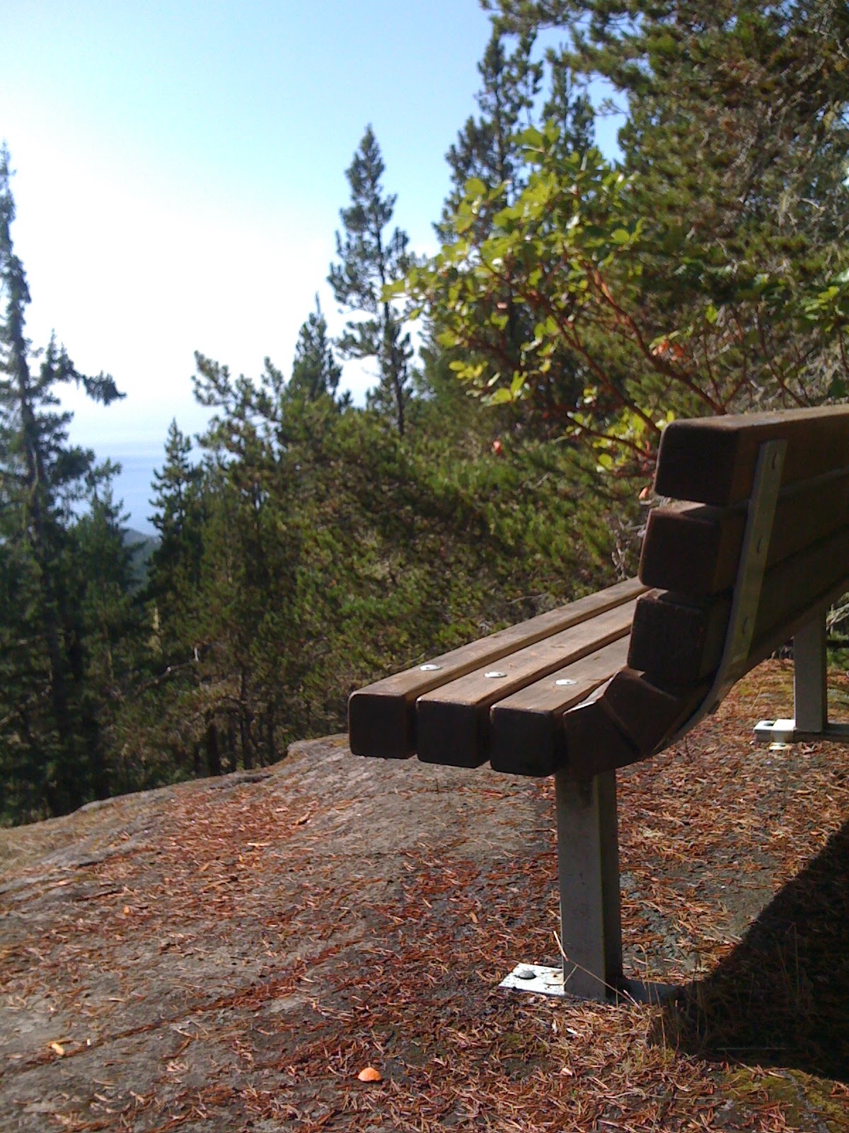
We looped onto the Galloping Goose for the return to the car park, but turned off to visit the view point that no longer has much of a view because trees have grown up to obscure it. However, it was a nice place for a short break.

Getting back onto the Galloping Goose for the last few minutes did take us past some great views of Roche Cove.  However, the best views were from the view point opposite the car park.


As the description indicates, we did see sea stars moving over the broken shells as well as the little-neck clams and barnacles.  Overall, the hike was pretty well as described on the tin. We all agreed it was one of the best so far.


Roche Cove Regional Park

Click for map


Roche Cove Regional Park
Cedar Grove Hike
Trail Rating: Easy to Moderate
Approximate Hiking Time: 2 hours
Highlights
This hike will take you through classic temperate rainforest, with lush vegetation, oldgrowth cedar trees, and moss-covered big leaf maples. Enjoy spectacular views of Roche
Cove and look for huge banana slugs!
The Hike
Begin your hike in the Roche Cove parking lot. The trailhead for the Cedar Grove Trail is
on the north side of the parking lot, well before the pit toilets and picnic tables.
Follow the trail along dry, rocky outcrops and up a moderate incline into the lush
temperate rainforest. Continue on the well-established trail down through large big-leaf
maples. Make sure to look up into the canopy, where the limbs of these giants support a
microcosm of licorice ferns, mosses and lichens.
Once you start heading uphill again, the viewpoint sign may tempt you to follow a short
trail to the right. The end of this trail is a peaceful place to stop and have lunch, although
trees now obscure the view. Keep heading north and at the first fork in the trail, go right
(left will take you to Gillespie Road). In approximately 15 minutes you will encounter a
huge fallen cedar, one of several cedars in this grove that are well over 500 years old.
Continue past the Cedar Grove and you will find the trail less travelled. An alder forest
on your left is an excellent birding spot in the fall and spring. Keep following the trail
until you start to descend and you will come out onto the Galloping Goose Regional
Trail. To return to the Roche Cove parking lot, follow the Galloping Goose Trail to the
right. Take the time to look at the road-cuts that made this abandoned rail line possible.
You will find patches of stonecrop, a native succulent that blooms in late spring/early
summer.
If you have a few extra minutes and are craving more forest, turn right at the To
Viewpoint sign. This trail will take you up through the forest and eventually loops back
onto “the Goose.” This scenic route takes only an extra 10 minutes.  Before you reach the
parking lot, turn to your left to enjoy the stunning view of Roche Cove.