Car poolers will be leaving the Centre at 9:15 and arriving at the trail head at approximately 9:45.
The hike is 10k and is one of the most interesting and scenic in our repertoire. Elevation change is about 1500ft (only about 460 metres - sounds better!)
Bring a light lunch.
Directions Map
View Larger Map
Mount Manuel Quimper access is via Harbourview Rd. Drive down Harbourview 750 m to the parking lot.
Hike Report, June 25, 2013
Four of us braved the rain to enjoy the view from the top of Mt Quimper. There were seven other hikers up there today as well. Popular place!
Track
View Mt Quimper - June 25, 2013 in a larger map
Photos
Dwayne's recon 2012
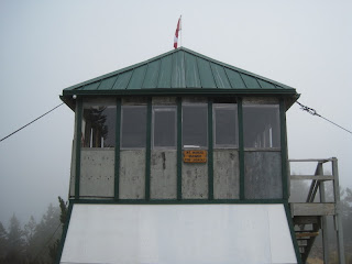
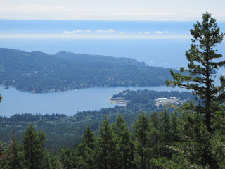
I hiked up Mount Manuel Quimper. It was great! 1500+ feet vertical, 10-12 km (depending on whether you miss the turnoff), but the view of Sooke Harbour was superb. I wished I had a panoramic option on my camera. It has one of the very few remaining BC Forest Service Fire lookouts on Vancouver Island, which was built in 1951. Most accessible lookouts have been decommissioned by the Forest Service due to vandalism. Mt Quimper is in Sooke Mountain Provincial Park. The park was established in 1928, but has no established facilities, other than the parking lot at the end of Harbourview Road.
https://maps.google.ca/maps/
Sooke Mirror Article
Hike Report October 2, 2012
Track
https://maps.google.ca/maps/
View as advertised:
Actual View ;-):
Pictures from Dwayne's recon


No comments:
Post a Comment